LiDAR SLAM vs. Camera-Only SLAM for Outdoor AMR Navigation
LiDAR's darkness tolerance beats cameras, but weather and cost trade those gains away outdoors.
Most of the SLAM literature cited in comparison pieces got built and tested indoors, in tightly controlled lab conditions, and those conclusions don't hold once the robot goes outside. That gap is the actual subject here: outdoor deployment breaks assumptions that indoor testing never had to question, and picking a SLAM approach based on indoor benchmarks is close to picking a raincoat based on how it performs indoors.
Four stressors organize everything that follows. Lighting swings from direct sun to full shadow inside a single run. Terrain turns unstructured and uneven: ramps, loose gravel, tall grass. Weather brings rain, fog, snow, dust. And GPS drops out or degrades under tree canopies, in urban canyons, underground.
SLAM versus GPS for outdoor localization
SLAM stands for simultaneous localization and mapping. It lets a robot, drone, or self-driving vehicle build a map of a space it has never seen while tracking exactly where it sits inside that map, without leaning on an outside positioning system.
The mechanism is plain once laid out. Sensor data comes in, a laser return or a camera frame, and the system pulls out identifiable features and matches them against the map it has already built. It estimates the robot's position and updates it on the fly. When the robot circles back to a spot it already mapped, loop closure kicks in: the system recognizes the place, corrects the drift that built up along the way, and tightens the map accordingly.
GPS looks like the obvious backup, until the signal just isn't there. Dense tree canopies and similar overhead cover can block or degrade GPS signals enough to make reliable localization difficult. Underground spaces, urban canyons, and jammed environments remove the fallback entirely. Judging either SLAM modality by how it performs with GPS standing by misses the point: both exist to provide localization precisely when GPS cannot, and their respective failure modes matter more because of it. That's the frame the rest of this piece uses.
How LiDAR SLAM builds and maintains a map outdoors
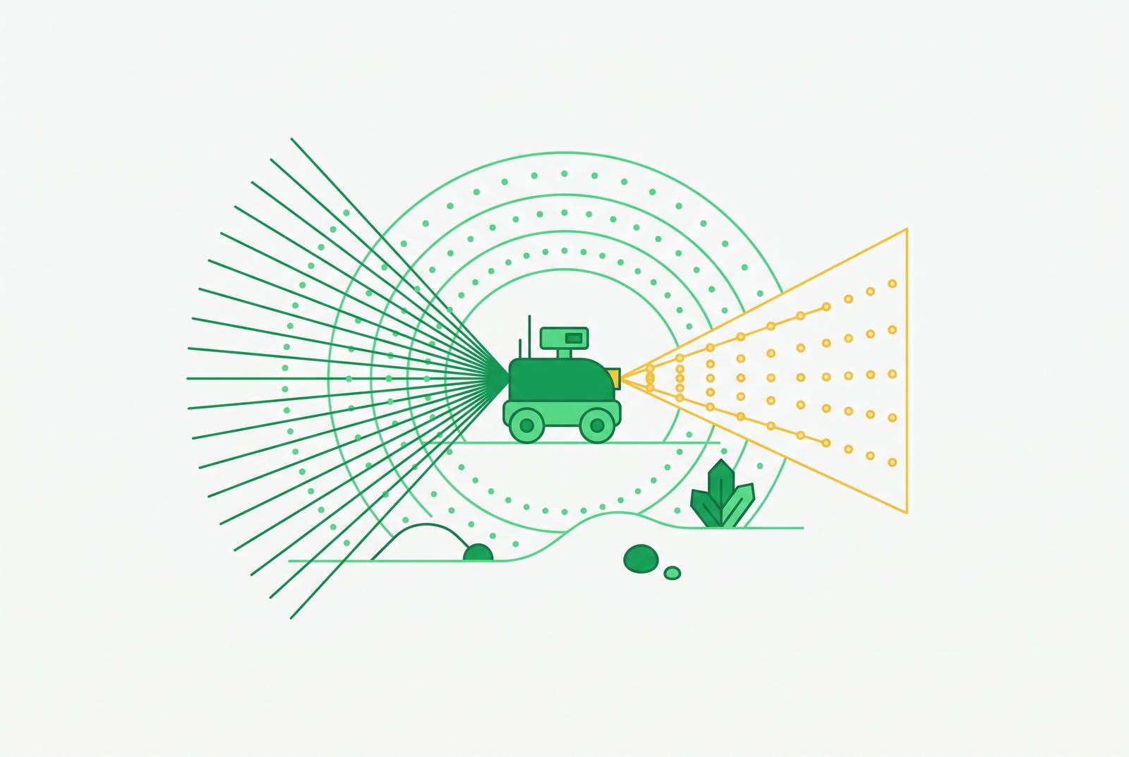
Firing thousands of laser pulses and timing the return gives distance, depth, and shape, producing a high-resolution 3D point cloud in real time.
From there, the algorithm pulls geometric features out of the cloud, planes, edges, corners, and matches them between successive scans. A back-end optimization step cleans up the error that piles up across the whole trajectory, and loop closure catches the robot whenever it revisits familiar ground.
One distinction matters more outdoors than almost anywhere else. A 2D LiDAR scanner sees a single horizontal slice of the world. A 3D unit sees the ramp, the curb, the low obstacle, the branch hanging into the path, the patch of tall grass, the dip where the ground sags. Indoors, where floors stay flat and predictable, that gap barely registers. Outdoors, it decides whether the robot notices the curb before it hits it.
For large-scale outdoor deployment, fusion variants push LiDAR's reach further still. LOAM-GPS-IMU tightly couples LiDAR data with an inertial measurement unit and GPS global constraints, suited to the scale that large outdoor sites demand.
Where LiDAR SLAM holds up in outdoor conditions
Darkness doesn't bother LiDAR. The sensor makes its own light through the laser pulses it fires, so it keeps working at night and in smoke, conditions where a camera sees close to nothing.
The terrain-handling advantage carries straight through here. 3D point clouds pick up ramps, vegetation, curbs, and uneven ground that a 2D sensor misses entirely, and that feeds directly into path planning for any AMR working outside a warehouse.
Where LiDAR SLAM breaks down outdoors
Weather is the hardest unsolved problem in outdoor LiDAR, and no fusion trick fully gets around it. Fog, rain, and snow all put airborne particles in the air that scatter or absorb the laser pulses the whole system depends on, and point cloud quality suffers for it. Raindrops themselves can register as false obstacles on the safety laser, and fog, snow, dust, and even harsh direct sunlight produce that same false-positive effect.
Certain surfaces trip LiDAR up regardless of weather: transparent glass, mirrors, highly reflective metal, dark matte materials, anything struck at a steep incidence angle. Thin or vertical objects, a chain-link fence post, a narrow railing, tend to slip past detection too.
Then there's the integration burden. Tightly coupled LiDAR frameworks demand precise synchronization and calibration between sensors, and the computational load runs high, particularly on embedded hardware or in any setting where the robot moves fast and the scene keeps changing.
Cost still sits as a real barrier, not a footnote. Solid-state LiDAR development may cut costs by up to 50% over the coming years, a relevant signal for buyers weighing total cost of deployment today versus in the near future.
How camera-only SLAM builds a map outdoors
Camera-only SLAM starts from a simpler premise. Capture images continuously, pull out key visual features, edges, textures, distinct objects, and track how those features shift frame to frame to work out the robot's position and orientation. From there it builds either a 2D or a full 3D map using ordinary computer vision techniques.
The appeal starts with the hardware. Cameras are lightweight, compact, and draw less power, which makes them easier to mount on smaller AMR platforms. They cost considerably less too, which lowers the entry price for outdoor AMR fleets that don't need centimeter-level geometric precision on day one. And cameras capture something LiDAR structurally cannot: texture, color, object identity, on top of raw geometry. A point cloud simply doesn't carry that.
One outdoor use case makes the argument directly. Dense tree canopies and similar overhead cover can block or degrade GNSS signals, and Visual-Inertial SLAM has been applied to outdoor robotic settings where that kind of signal loss is a real concern.
A handful of systems anchor this space in practice. On the traditional side: ORB-SLAM3, VINS-Fusion, OpenVINS, Kimera, SVO Pro. On the learning-based side: HFNet-SLAM and AirSLAM.
Where camera-only SLAM fails outdoors
Lighting is where camera SLAM runs into trouble, and outdoors, lighting never holds still. Commercially available visual SLAM systems perform poorly, or fail outright, under the lighting swings that happen constantly outside: sunrise glare, sunset shadow, cloud cover rolling through, direct sun cutting against deep shade. None of that counts as an edge case outdoors. It's the baseline condition, and any evaluation that treats it as occasional is testing the wrong thing.
Drift compounds the problem. Visual SLAM builds up positioning error over time, and that error worsens under unstable lighting or in scenes with a lot of motion. Visual SLAM builds up positioning error over time, and that error worsens under unstable lighting or in scenes with a lot of motion, which makes loop closure an important component for keeping drift in check over long runs. At outdoor scale, where a robot might travel long stretches between chances to revisit a known landmark, that drift has more room to grow before anything corrects it.
Dynamic scenes make things worse still. Vehicles, animals, and people moving through the operational area contaminate the feature tracking a camera system depends on, and current systems still struggle badly with moving objects, especially the distant, small ones that are hardest to flag and filter out.
Longevity is its own separate failure, and arguably the least forgiving one. Visual SLAM setups face real challenges sustaining reliable navigation as environments change over extended service periods. Map maintenance grows more demanding as the operational environment expands and changes, and keeping a map current is a non-trivial computational task. Outdoor environments don't hold still season to season either: vegetation grows in, surfaces weather and change color, and all of that compounds the basic fact that a static map goes stale.
Dynamic environments and adverse weather as the shared stress test for both modalities
Moving objects don't discriminate by sensor type. Vehicles, animals, and people passing through a robot's operating space corrupt feature matching and map consistency whether the system underneath runs on LiDAR or cameras. Systems like ORB-SLAM3 are designed for feature-rich environments and face well-documented challenges once scenes turn complex and dynamic.
Research has explored mitigation strategies ranging from object-detection-based filtering to more precise segmentation-based approaches, each carrying different trade-offs between speed and accuracy. Neither is fully solved. Efforts to integrate dynamic object removal into existing SLAM pipelines have shown promise for improving trajectory accuracy under heavily dynamic conditions. Call it progress, not resolution.
Research has pointed to real limits in LiDAR's perception under bad conditions, alongside a few practical mitigations. Separately, the SLAM Adversarial Lab (SAL) framework, published in 2026, offers a modular way to test visual SLAM specifically against adversarial conditions like fog and rain. Its existence says something on its own: the field now treats weather as a first-class test, not a footnote.
In heavy rain or dense fog, the geometric edge LiDAR supposedly holds over cameras partly falls apart, because particle noise in the air corrupts the range measurements the whole system leans on. Cameras lose out too, for a different reason entirely: visibility itself degrades. The practical result lands in the same place either way, neither modality walks away from bad weather with a clean win.
That convergence, both sensor types hitting a wall under the same conditions, is the strongest argument against picking one and calling the problem solved.
Sensor fusion as the practical answer for demanding outdoor deployments
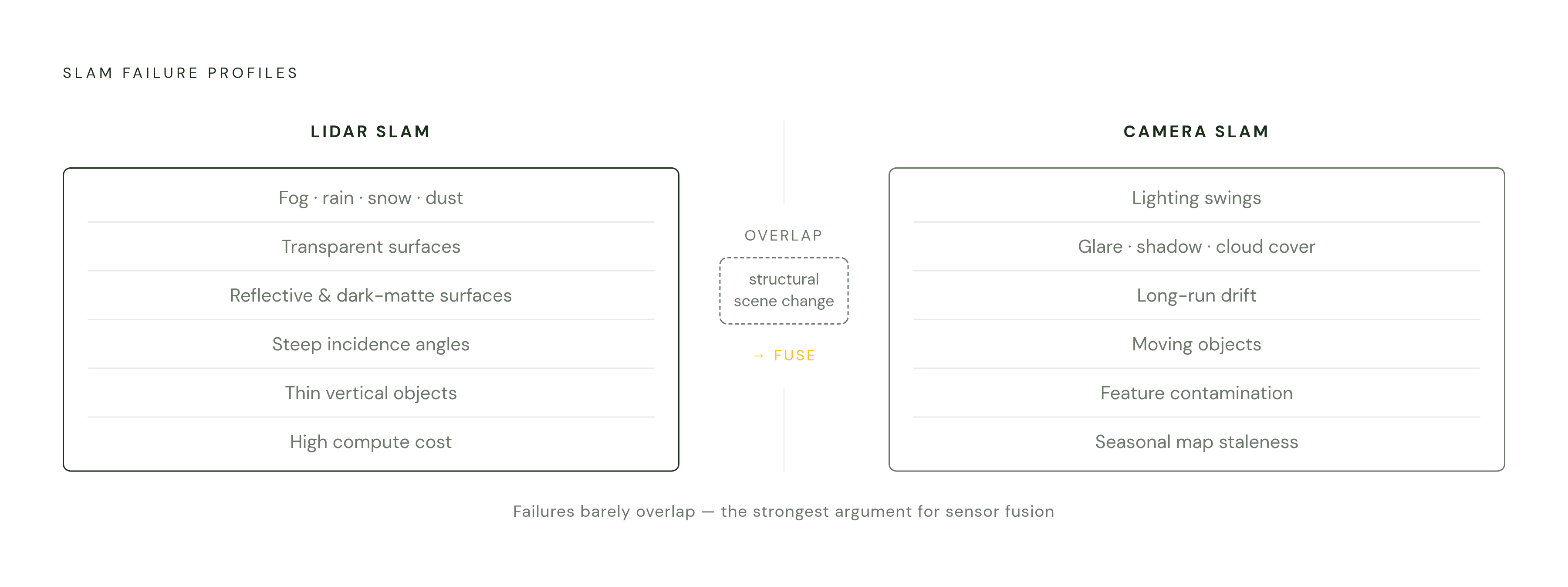
Lay the two failure profiles side by side and they barely overlap. LiDAR falters in heavy weather and carries a real cost burden. Cameras falter in low light and lose reliability as distance and time stack up. LiDAR brings geometric stability that holds regardless of ambient light. Cameras bring texture and semantic detail no point cloud can supply.
Fusion isn't a theoretical fix, either. LOAM-GPS-IMU already combines LiDAR with an IMU and GPS constraints specifically to handle large-scale outdoor sites. AMB3R-SLAM, built originally as a monocular, camera-first system, shows that adding LiDAR as a supplementary input drives absolute trajectory error down to sub-meter levels on both the KITTI and VBR datasets. That's not a marginal result. For outdoor AMR navigation, the choice between LiDAR SLAM and camera-only SLAM hinges on a distinct set of environmental challenges (lighting variability, unstructured terrain, weather, and GPS-denied zones) that expose the strengths and limits of each approach in ways indoor comparisons rarely surface. The system that wins leans on whichever sensor is doing the reliable work at a given moment, weather, light, and terrain all weighed in together, rather than betting everything on one and hoping the conditions cooperate.
Sources
- GPS‐Denied LiDAR‐Based SLAM—A Survey - Jiang - 2025 - IET Cyber-Systems and Robotics - Wiley Online Library
- AMB3R-SLAM: Kilometer-scale SLAM with Hierarchical Backend
- Visual‐Inertial SLAM for Unstructured Outdoor Environments: Benchmarking the Benefits and Computational Costs of Loop Closing - Schmidt - 2025 - Journal of Field Robotics - Wiley Online Library
- (PDF) Featureless Visual Processing for SLAM in Changing Outdoor Environments
- sciencedirect.com
- sciencedirect.com
- researchgate.net