RTK-GPS Navigation in Unstructured Farm Fields
Centimeter-precise positioning fails where crops grow densest, forcing robots toward sensor fusion.
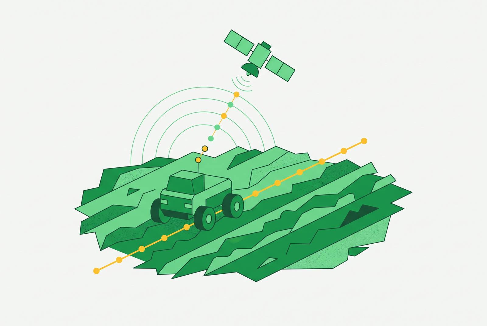
A field machine knows its own position to within a few centimeters with RTK-GPS, but a standard GPS can't do that. That precision is the reason it became the default navigation standard for precision agriculture, and it is the baseline this piece tests against the messier conditions of a real, growing field.
RTK-GPS: the standard for field navigation
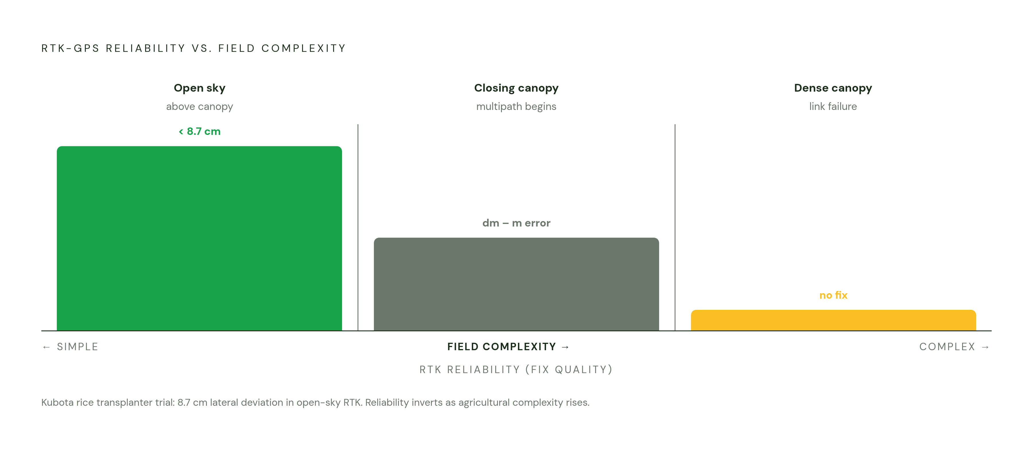
A standard GPS receiver gives a farmer a position good to several meters, and that sounds adequate until a planter overlaps a pass or leaves a gap uncovered because the machine thought it was somewhere it wasn't. Real-Time Kinematic GPS closes that gap through a different mechanism than plain satellite positioning. A base station sits at a fixed, known location, works out how far off the incoming satellite signals are from what they should be, and sends that correction to a rover in the field in real time. The rover applies the correction and arrives at a fix measured in centimeters rather than meters. Most RTK receivers now pull from four satellite constellations at once, GPS, GLONASS, Galileo, and BeiDou, which gives the system more signals to work with and makes a usable fix easier to hold onto. None of this is free of constraints: the distance between base station and rover matters, because the farther apart they sit, the more the atmosphere above each one can differ, and that difference eats into the accuracy the correction was supposed to deliver. A Kubota rice transplanter fitted with RTK-GPS and an electronic compass shows what the technology can do under good conditions: a verified maximum lateral deviation of less than 8.7 centimeters at low speed, holding that control through both curved and straight paths. This is a controlled demonstration, run in conditions built to let RTK perform. The rest of this piece is about what happens when those conditions are not met.
What "unstructured" means
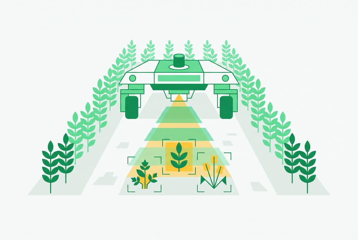
A farm field is not simply dirt without pavement. An unstructured field brings together irregular planting geometry, canopy that blocks the sky, and terrain rough enough to shake a machine's sensors, and these three problems hit an RTK-based navigation system from three different directions. They are not the same kind of problem, and treating them as if they were is where a lot of navigation designs go wrong. Irregular planting, gaps where seed failed to come up, erosion that reshaped a row, row spacing that drifts over the length of a field, is a geometric problem: the reference points a machine expects to see come and go unpredictably. Canopy occlusion is a signal problem: once a crop matures enough to close its canopy over the space between rows, a compact robot working underneath it is operating in conditions where satellite signals often cannot reach the receiver. LeCropFollow, accepted in June 2026, states that standard GNSS-RTK solutions degrade from signal multipath error in exactly these occluded environments, at the same time that robots are required to navigate the narrow, GPS-denied space beneath the canopy. Terrain-induced vibration adds a third failure mode, distinct from the other two: uneven ground generates high-frequency mechanical shocks that corrupt the inertial measurement unit data that fusion systems depend on to bridge gaps in GNSS coverage. Research out of Iowa State tied to the Salin247 robot shows that these sudden terrain disturbances cause standard Kalman filter models to lag and build up error, because those models lack the higher-order jerk terms they need to track sudden changes in motion. A fourth issue sits alongside these: in a conventional linear row layout, the view from a camera or LiDAR unit looks nearly identical at every point along a row, a condition known as perceptual aliasing, and research from the University of Colombo and the University of Lincoln (the Crop Spirals project) identifies this repetitive geometry as a structural obstacle to precise localization in its own right.
Multipath and canopy cover against RTK's correction loop
Under-canopy navigation exposes a structural weakness in how RTK works: the differential correction that makes RTK accurate depends on the rover receiving a clean satellite signal, but dense vegetation reflects and scatters that signal before it reaches the antenna. Multipath error is what happens when a satellite signal bounces off a leaf, a stalk, or wet soil before arriving at the receiver: the receiver cannot tell the direct signal from its reflected copies, and the resulting position fix degrades or drops out. This problem is not constant throughout a growing season. It gets worse as the canopy thickens, so a navigation setup that performs well at planting time can fail by the time the crop closes in over the row middles. LeCropFollow treats under-canopy navigation as a fully GPS-denied problem, so it replaces RTK at the perception layer instead of just adding more correction on top of it. A second, independent failure path runs through the correction link itself: RTK depends on a steady communication channel between base station and rover, and if that reference station goes offline, or the radio or cellular connection carrying the correction drops, the system falls back to uncorrected GNSS with meter-level error. FieldBee's documentation on its RTK system notes that corrections arrive either from an NTRIP provider over the internet or from a reference station over radio, and either path can fail in the field for reasons that have nothing to do with vegetation. Put the two failure modes together, and RTK's reliability runs in the opposite direction of what agricultural robots actually need, holding up best in open, simple fields and weakening exactly where dense, complex crop environments call for it most.
Sensor fusion as the working solution
The response to these limits in the field has not been to drop RTK but to narrow its job. In a fusion architecture, RTK supplies an absolute position fix that anchors the system, while LiDAR, cameras, and inertial sensors take over the moment-to-moment navigation work, especially when satellite signals weaken. GNSS-RTK's role in this setup is to act as a constraint that stops an IMU or odometry system from drifting over time, a supporting input rather than the thing actually steering the machine. How tightly that fusion is built varies a lot across real systems. The Salin247 robot, a four-track independent-drive electric vehicle built for precision farm tasks, runs IMU and GNSS as its core inputs into a jerk-augmented Extended Kalman Filter with axis-specific noise covariance adaptation, and adds a Fixposition Vision-RTK 2 sensor as a ground-truth reference to handle sudden terrain disturbances without throwing away valid lateral sensor readings. Naio Technologies builds its fusion more simply: the Oz robot uses GNSS RTK to hold its path along crop rows, and the Ted straddle robot uses the same kind of RTK guidance to move autonomously between vineyard rows. A robot built to remove plants infected with PVY (potato virus Y) uses an RTK GPS module from Swift Navigation to drive to plant locations identified earlier; this structured waypoint task is performed above the canopy, where RTK's open-field accuracy is enough on its own and no further fusion is needed. That contrast matters: it shows RTK performing cleanly when the task is above-canopy, visible to satellites, and geometrically simple, and it sets up exactly the kind of task, under-canopy, GPS-denied, geometrically irregular, where RTK alone falls short. FieldBee's commercial tractor auto-guidance product follows the same fusion logic at a product level, so it pairs RTK receivers with IMU sensors to compensate for terrain while driving. None of this makes fusion a finished answer. It is the working response to RTK's limits, not a resolution of them.
Where geometric fusion fails
Even a well-built fusion stack still runs into trouble when it depends on geometric methods, pulling crop lines, vanishing points, or row centerlines out of LiDAR or camera data, because those methods need the geometric features to actually be there. In a real field, they routinely aren't: planting gaps, erosion, and late-season canopy change all remove the reference points a geometric method is built to find. LeCropFollow's research traces the underlying cause to information loss: geometric methods take rich sensor data and compress it down to a thin, low-dimensional spatial reference, throwing away the uncertainty and semantic context a robot needs to make sense of ambiguous ground. LeCropFollow's answer is to skip that compression step. It combines a self-supervised semantic heatmap extractor with TD-MPC2, a model-based reinforcement learning planner, and plans a trajectory directly inside a learned latent representation of the scene rather than a geometric one. In field trials run in late-stage corn, where the canopy and the gaps are both at their worst, LeCropFollow cut semantic navigation failures by a substantial margin compared to keypoint-based geometric methods, with the advantage appearing specifically in planting gaps, while in structured rows without gaps the two approaches perform about the same. The system also demonstrated zero-shot transfer from simulated training to physical fields with no fine-tuning required, accomplished without using RTK for navigation. LeCropFollow is a research result, not a deployed product, but the direction it points to is clear: in unstructured under-canopy environments, the harder problem may be perception and planning rather than positioning.
RTK's emerging role as ground truth rather than primary navigation
Across this body of research, people use RTK less to steer a robot in real time and more to check whether something else steered it correctly. Researchers mount RTK receivers to pin down a true position, then let LiDAR or vision systems handle the live navigation work, a flip from RTK's original role that reflects what the technology is actually good at and where it runs into trouble. In open-sky conditions, RTK's centimeter-level accuracy is well suited to verification and calibration, tasks where the satellite link can be kept clean and absolute coordinates are the point. The Salin247 research follows the same pattern from a different angle: RTK-fused GNSS supplies the absolute position constraint inside the EKF fusion stack, but the jerk-augmented IMU carries the actual navigation load whenever GNSS drops out, and the system is built to keep working without RTK rather than to lean on it. Calibration and ground truth are the functions that let an entire autonomous system be trusted, and they happen to be different functions than steering the machine in real time.
The 2026 GPS datum shift
A change in the coordinate system itself is now a live operational issue for RTK users. The National Geodetic Survey is rolling out a phased 2025-2026 replacement of the NAD 83 and NAVD 88 datums, and any RTK field data tied to the old reference frames, A-B guidance lines, field boundaries, tile drainage surveys, is at risk of being wrong by the size of the shift once the new datum takes hold. Farmers running their own local RTK base stations, or using state-run RTN networks, need to recapture their field coordinates in the new datum, because their stored guidance lines and boundaries will carry the old frame's error forward into the new one. Farmers on major commercial satellite RTK networks are in a different position: Iowa State University precision ag engineer Luke Fuhrer and digital ag Extension specialist Doug Houser indicate that platforms like John Deere's and Trimble's should be unaffected through 2026, since those networks run on satellite-based corrections built to handle the transition themselves. The datum shift reveals a general rule: RTK accuracy is only as reliable as the reference frame it's measured against, and a frame that looks permanent can still move. Field data should be treated as valid for a given datum at a given time, a record that needs periodic rechecking.
Redesigning field geometry for tractable navigation
Everything so far treats field layout as fixed, so it asks sensors and software to cope with it. The conventional straight-row layout was built around what worked for a tractor, not what a small autonomous robot can reliably perceive: its tight headland turns and repetitive row views are a design choice, not a law of nature. Research from the University of Colombo and the University of Lincoln, under the name Crop Spirals, proposes a square spiral layout built around a central tramline, which turns the navigation task from a two-dimensional problem into a one-dimensional one. A robot following the spiral path can locate itself along a single coordinate running the length of the spiral, so it doesn't have to resolve its position across two axes at once. That shift doesn't fix every problem raised in this piece: canopy occlusion still blocks signals no matter the row shape, and terrain vibration still shakes an IMU on a spiral path just as it does on a straight one. But it removes the repeating-view confusion at its source, by changing what the robot has to look at rather than asking a smarter algorithm to make sense of a view that repeats itself for the length of a field.
Sources
- LeCropFollow: Latent Space Planning for Navigation in Unstructured Crop Fields
- Resilient Navigation for Autonomous Farm Robots by Leveraging Jerk-Augmented Models with IMU-Only Disturbance Rejection
- Crop Spirals: Re-thinking the field layout for future robotic agriculture
- Agricultural machinery automatic navigation technology - PMC